Data from Twitter has been used to all sorts of ends, including the real-time tracking of a disease’s outspread. Now, researchers are using the tweets to get real-time reports about an earthquake, so as to help guide the emergency responders.
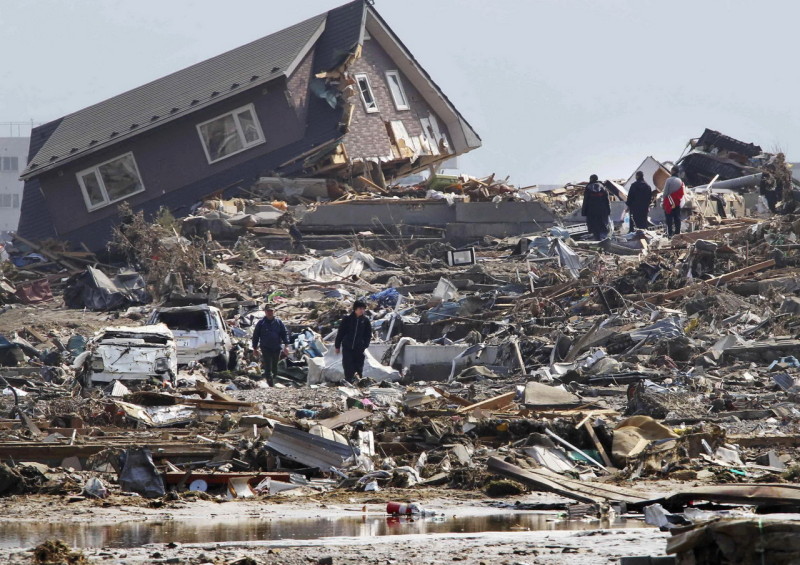
Typically, it takes a while for the monitoring stations and the inspection engineers to determine the eye of the storm, the site where the earthquake actually wrecks damage. This leads to delay in dispatching the emergency responders, losing precious time during which countless people may be stranded in dangerous situations, needing immediate help.
This is why a team of researchers at Stanford University is trying to speed up the process of reporting and tracking earthquakes. To do this, they are aiding ShakeMaps, an initiative created by U.S. Geological Survey to track earthquakes in real-time. In order to help improve the accuracy and timeliness of these earthquake reports, the Stanford University is making use of tweets.
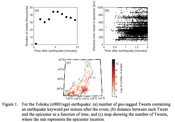
The key aspect which makes Twitter immensely useful is its real-time nature. Twitter users often tweet instantly as soon as they feel an earthquake jolt. This data, when aggregated in an automated manner, can soon reveal which region is hit with a significant magnitude of earthquake at any given time. In order to gather the relevant tweets, the researchers have narrowed down the search criterion to geo-tagged tweets which contain specific terms such as ‘earthquake’ or ‘tsunami’ in a number of languages.
The team has experienced success so far. According to them, the “counts of geo-tagged tweets at different radii around a particular site are good predictors of shaking intensity when used in combination with earthquake-based features such as VS30 [a global map server] and source-to-site distance.”
Such timely information about earthquakes can be very useful for first responders who can go out for help almost instantly. Tweets can also be used to determine the scope of a given earthquake, allowing the responders and authorities to plan accordingly and timely.
Source: Stanford
Courtesy: TechCrunch
[ttjad keyword=”chrome-laptop”]