NASA has released the largest ever map of Moon‘s north pole. The map is a compilation of thousands of high-resolution images and has been made available for free as an interactive, zoomable tool.
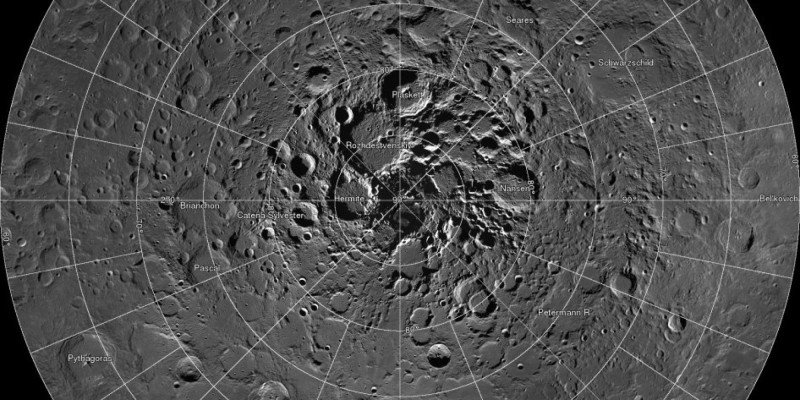
The extensive map has been compiled, thanks to NASA’s Lunar Reconnaissance Orbiter (LRO). It was set out back in 2009 and tasked with taking detailed, high-resolution images of the moon’s surface. This information is then to be used to determine proper landing spots for future missions and the presence of different minerals and water.
Over the course of four years, LRO took thousands of photos of Moon’s north pole. Scientists then picked 10,581 of these images which are ultra-high-res, and turned them into a huge map. To give you a measure of this map, it comprises of 681 billion pixels.
The method used by the LRO to gather images of the moon’s surface is also quite interesting. LRO took an image of the same latitude every two hours over the course of the month. Moon’s rotation ensures that each part of a given latitude passes under the eyes of the LRO’s camera. In this way, LRO is able to gather an extensive collage of moon’s images.
The map has been made available online as a very interesting, interactive tool. You can either zoom into the map yourself or click any of the thumbnails at the bottom of the page to take you to specific views of the Moon.
Source: Lunar Reconnaissance Orbiter Camera
[ttjad keyword=”ipad”]


