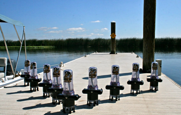
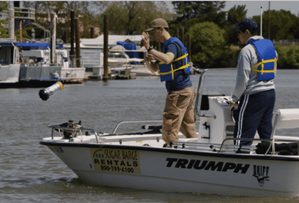
A group of engineers at University of California have deployed a fleet of 100 floating robots down the Sacramento River in a field test to track water flow on 9 May, 2012. The robots, equipped with GPS enabled smartphones, demonstrated the next generation of water monitoring technology. Engineers are hoping that the solution will transform the way government agencies monitor the state’s water resources.
The Floating Sensor Network project is led by associate professor Alexandre Bayen. The project is supported by Center for Information Technology Research in the Interest of Society (CITRIS) and the Lawrence Berkeley National Laboratory (Berkeley Lab), and has been tested in collaboration with the U.S. Department of Homeland Security and the U.S. Army Corps of Engineers. It is an evolution of earlier research led by Alexandre Bayen on Mobile Century and Mobile Millennium, which used GPS enabled smartphones for monitoring traffic flow.
Explaining the importance of water supply monitoring and how the project will help realizing this goal in a better way, Bayen said,“Monitoring the state’s water supply is critical for the general public, water researchers and government agencies that rely upon costly fixed-water sensor stations that don’t always generate sufficient data for modeling and prediction. The mobile probes we are using could potentially expand coverage to hundreds of miles of natural and manmade channels that are currently under-monitored, and help agencies responsible for managing the state’s limited water supply. We expect this to become an invaluable tool for the future management of a critical resource in this state and around the world.”
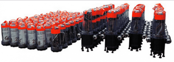
During the field test, 40 robots, out of the 100 robots deployed, were equipped with propellers that let them avoid obstacles and move around it or targeted areas as autonomous robots. Each sensor was encased in a 12 inch long watertight capsule marked with fluorescent tape, a battery and a GPS-equipped smartphone with a custom-built Android app, which sends information back to a lab every few seconds. According to the engineers, the sensors can shed light into how the water moves and how pollutants are spread. Engineers hope that the sensors would provide data on how salt and fresh water in Delta’s ecosystem combine. As the sensors are mobile, they can also be easily deployed to monitor an emergency situation, such as an oil spill. Each robotic sensors can stay in the water for 24 hours before the battery goes dead.
Important facts at a glance :
The robotic hardware has gone through a series of evolutions, and the 4th-generation ‘drifter’ devices include these capabilities:
* The use of GPS technology to track surface water flow;
* Drive motors to move to a desired GPS point at approximately 0.5 m/s;
* Flow and quality data sent in real-time using the GSM network.
* Buoyancy control systems to “dive” to 5m depth.
* The capability to measure salinity in real time;
* A 72-hour operational lifetime.
At present, the sensors cost a few thousand dollars each, but Bayen expects the cost of the project will be reduced while its performance will improve. He also expects the floating robots to become an invaluable tool for the future. For more, visit University Of California, Berkeley.
Here’s a video of the floating sensor field test. Take a look.
Source : University Of California, Berkeley
[ttjad keyword=”android-phone”]


At present, the sensors cost a few thousand dollars each, but Bayen expects the cost of the project will be reduced while its performance will improve.
At present, the sensors cost a few thousand dollars each, but Bayen
expects the cost of the project will be reduced while its performance
will improve.