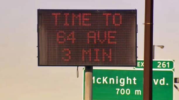
Usually, you know how long it would take you to reach a place given its distance from your present location. But often, you end up miscalculating the amount of traffic congestion on the road, leading to delays. Now, the City of Calgary in Canada is implementing a bluetooth detection system which would calculate the time to travel between two places, in real time.
The city authorities have decided to make use of Travel Time Information System. For now, this bluetooth detection system will be used only along the Deerfoot Trail. The system essentially detects the presence and movements of a device along the route through its bluetooth waves.
By tracking these waves in real-time, the system is able to then calculate the amount of time a driver may require to move between two points based on the congestion on the route. This information is then displayed on message boards so that those travelling on the road can estimate the total time of their journey and may take an alternative route if they need to.
According to the Manager of The City of Calgary’s Roads Traffic division, Gord Elenko, “Now we can deliver accurate information about travel times directly to drivers during their commute. Drivers will be able to make informed route planning choices in real time. We believe it will eventually help reduce congestion and decrease driver frustration.”
The system is also able to distil any random signals generated by those walking on foot along the road, thus maintaining the accuracy of its calculations. The best thing is that while detecting the bluetooth waves of individual devices, the system doesn’t collect any other information, thus guarding the privacy of the users.
Source: CTV News
Courtesy: SlashDot
[ttjad keyword=”chrome-laptop”]


