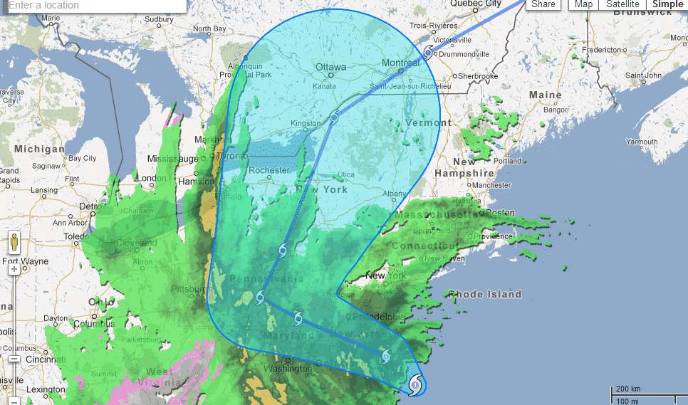
Hurricane Sandy is currently among the most buzzing topics in the social media. The tropical cyclone is expected to hit NYC soon and given the sheer force it garners, it can wreck quite a damage. Google has now updated its Crisis Map to give more information and a clearer view of Sandy’s path.
What is Sandy?
Sandy is a tropical cyclone that didn’t spring up all at once. Rather, the tropical cyclone has been forming shape and gaining speed and strength over the past one week. Before it reaches the East Coast of the U.S., it has already caused significant damage to a number of other regions such as Jamaica, Cuba, Haiti and the Bahamas.
The severity of this cyclone can be gauged from the fact that Sandy is the largest hurricane in the Atlantic history. In anticipation of the cyclone, New York City, which lies in its path, has completely shut down with the authorities taking measures to ensure that no lives are lost during the ordeal.
Google’s Crisis Map:
Google had earlier dished out a Crisis Map which gives a wealth of information about Sandy. It has now updated the map to include additional details such as the path of the storm, its present location as well as regional alerts.
Moreover, you can select specific events to get more information about the storm. For instance, the map can tell you about the expected rainfall Sandy will trigger or the traffic conditions that can result from it. For those residing in regions which come in Sandy’s path, information about evacuation routes can be very helpful.
You can head straight to the Crisis Map to dig into additional information about Sandy.
Source: Crisis Map
Courtesy: Electronista
[ttjad keyword=”samsung-laptop”]


