Researchers at Carnegie Mellon University and INRIA/Ecole Normale Supérieure in Paris have developed a visual data mining software that can automatically identify which city it is. The interesting thing is the software can recognize Paris easily, but it faces more trouble identifying geo-informative elements for U.S. cities.
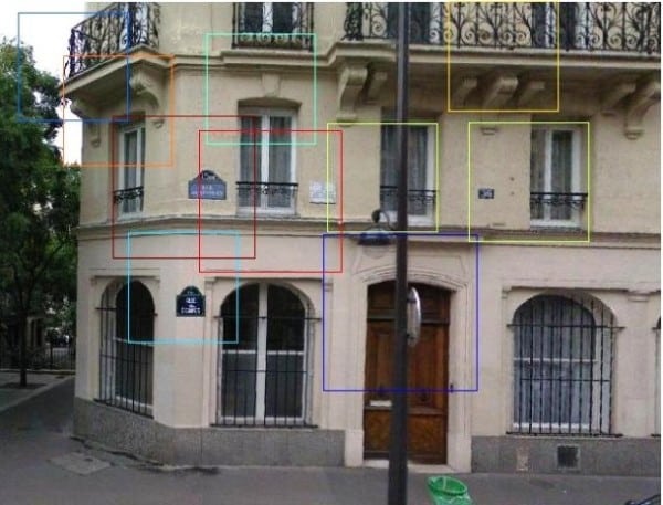
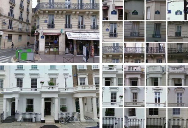
To identify a city, the software observes the street signs, streetlamps and balcony railings of the surrounding buildings etc. The software analyzed more than 250 million visual elements gleaned from 40,000 Google Street View images of Paris, London, New York, Barcelona and eight other cities to find those that were both frequent and could be used to discriminate one city from the others. This yielded sets of geo-informative visual elements unique to each city, such as cast-iron balconies in Paris, fire escapes in New York City and bay windows in San Francisco.
“Visual Data is much more difficult, so the field of visual data mining is still in its infancy, but I believe it holds a lot of promise. Our data mining technique was able to go through millions of image patches automatically — something that no human would be patient enough to do,” said Efros, who collaborated with colleagues including Abhinav Gupta, assistant research professor of robotics, and Carl Doersch, a Ph.D. student in CMU’s Machine Learning Department. “In the long run, we wish to automatically build a digital visual atlas of not only architectural but also natural geo-informative features for the entire planet.”
The researchers started with 25,000 randomly selected visual elements from city images that were gathered from Google Street View. The software then analyzed these visual elements to determine which details made them different from similar visual elements in other cities. After several iterations, the software identified the top-scoring patches for identifying a city.
For Paris, those patches corresponded to doors, balconies, windows with railings, street signs (the shape and color of the signs, not the street names on the signs), and special Parisian lampposts. But, the software faced more trouble identifying geo-informative elements for U.S. cities, which the researches attributed to the relative lack of stylistic coherence in American cities with their melting pot of styles and influences.
Alexei Efros, CMU associate professor of robotics and computer said, “Our data mining technique was able to go through millions of image patches automatically; something that no human would be patient enough to do. In the long run, we wish to automatically build a digital visual atlas of not only architectural but also natural geo-informative features for the entire planet.”
If you think, you know Paris better and recognize its places then you should take part in Paris-nonParis test.
Source : CNET
[ttjad keyword=”social-media-samrtphones”]


