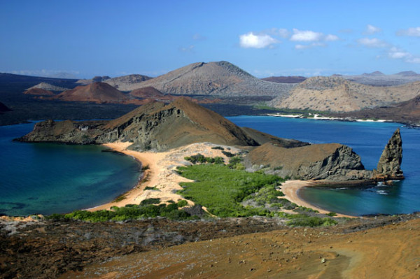
Google Street View is a technology featured in Google Maps and Google Earth that provides panoramic views from positions along many streets in the world. We reported that Google intends to add Galapagos Islands to Street View. The good news is from now on, you can explore the Galapagos Islands with Google Street View as the company has added it in its system.
Galapagos Islands are one of the most biodiverse places on Earth. The principal language on the islands is Spanish and the islands have a population of slightly over 25,000. However, the Galapagos Islands and their surrounding waters form an Ecuadorian province, a Galapagos National Park, and a biological marine reserve. One thing you may not know that the Galapagos was the key in Charles Darwin’s findings in forming the the scientific argument of evolution.
However, in partnership with Galapagos National Park and the Darwin Foundation, Google spent 10 days down in the Galapagos in May in order to mapping the island using the endearingly goofy Trekker imaging backpacks. Googlers were able to catch such sites as recently hatched baby tortoises and blue-footed boobies doing their mating dance. Using an SVII underwater camera from another partner—the Catlin Seaview Survey—Google also nabbed some underwater imagery.
You may never get to travel the Galapagos Islands, but now thanks to Google as its Google Maps offer virtual tour of the Galapagos Islands . From now on, you can explore it through 360-degree imagery on Street View. Viewers will be able to see much of the Galápagos’s wildlife, including marine iguanas, blue-footed boobies and Frigatebirds. Here’a video of the Galapagos Islands.
Source: Google Blog
[ttjad keyword=”monitor”]


