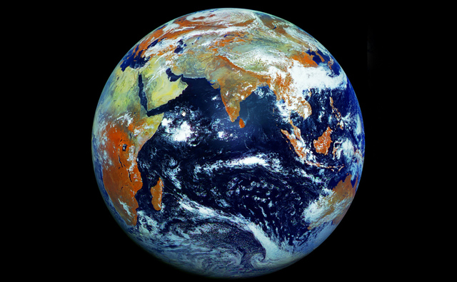
We have seen the images of the earth taken by NASA’s 64-megapixel “Blue Marble“. A Russian weather satellite, Elektro-L, has broken that record. Elektro-L has taken a 121-megapixel single image of Earth. As believed by some, the captured image shows the planet in more color and detail compared to previous imagery available.
Elektro-L was positioned at a geostationary orbit, 36,000 kilometers above the Indian Ocean. The images were obtained beginning on May 14th, and end on May 20th. The images have a resolution of 1 kilometer (0.62 mile) per pixel. The satellite captured the Earth in one shot instead of a collection of pictures from multiple flybys stitched together. The images were taken in four different wavelengths of light – three visible and one infrared. The infrared light is reflected by forests and vegetation, which appear orange in the image.
James Drake, who processed the image, collected more than 350 full-resolution photos from the NTs OMZ (Russian Research Center for Earth Operative Monitoring), created several videos of Earth. So far, till now, this is the highest-resolution image of Earth. You can access the zoomable version of the image at planet–earth.ca
Source : Planet Earth (James Drake)
Thanks To : Gizmodo, CNet
[ttjad keyword=”dslr-camera”]

