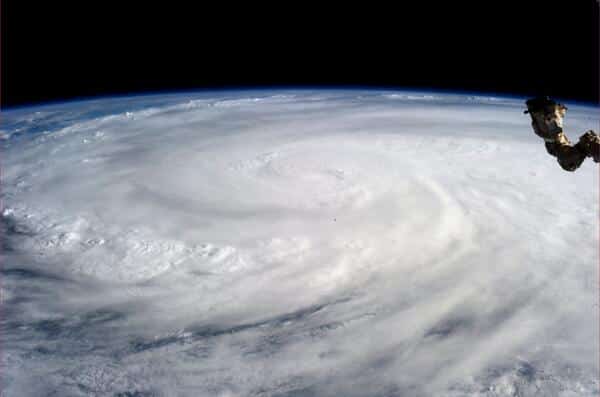
Super Typhoon Haiyan is considered is one of the strongest storms in world history based on maximum wind speed. The monster storm has already pounded Philippines and devastated the country. International space agency NASA’s satellite Aqua has been keeping an eye on Super Typhoon Haiyan for the past few days. Here, we have brought some images of ferocious Super Typhoon Haiyan taken from space.
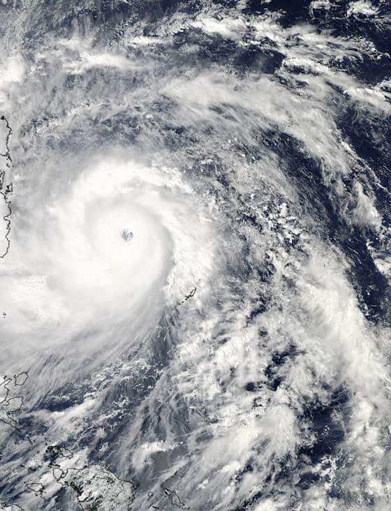
The above image you see is the image of Super Typhoon Haiyan taken by Aqua’s Moderate Resolution Imaging Spectroradiometer instrument (MODIS) at 12:25 p.m. local Philippine time on Thursday (11:25 p.m. EDT on Wednesday), heading towards Philippines. The image shows the broad bands of thunderstorms surrounding Haiyan’s eye. Haiyan had a wind speed of of 200 mph (320 km/h) and later it raised to maximum 230 mph (370 km/h). This was the fastest and the most powerful tropical cyclone recorded after 1979’s Super Typhoon Tip.
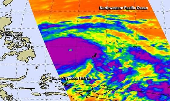
On the other side, another Aqua instrument named Atmospheric Infrared Sounder (AIRS) gathered infrared data on the typhoon, measuring temperatures –63.15C (-81.67F or 210 degrees kelvin) at Haiyan’s cloud tops and at the surface of the sea. These cold temperatures indicated that there would be a very high, powerful thunderstorms with very heavy rain fall. NASA has mentioned that Super Typhoon Haiyan is equivalent to a Category 5 hurricane.
It is to be noted that a tropical storm is considered a typhoon when its wind speeds reach 74 mph (119 km/h). A typhoon becomes super typhoons its winds reach 150 mph (241 km/h), making it equivalent to strong Category 4 or 5 hurricanes.
Source: PopSci
[ttjad keyword=”mac”]


