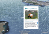
Google Earth is a wonderful software offering a vast array of information that travelers could really use. But until now, the information has been limited to people traveling on land. Now it seems Google wants us to venture out into and discover the oceans, helped largely because Google Earth now includes layers of information and annotations for all oceans.

Last year all the oceans were 3D mapped, and had video and photos added for good measure—but it’s taken a while longer to add all of the information one would need in the default setting of Google Earth. Google’s worked with Sylvia Earle’s Mission Blue Foundation and over 100 other partners, including the National Geographic, videographers, divers and governments, to ensure every drop of water has information that can be read about it.
“Although a humble step given the dearth of information available about these vast expanses of geography, we are happy to take one more step to make the oceans a first-class part of Google Earth and to give them at least a starter portion of the thick soup of photos and places that describe the land part of the planet,” explains Google.
“One of the greatest things about Earth is that it allows everyone to see and experience the fullness of their planet, from revisiting places they know well to venturing out to formerly unknown mountain peaks, desert vistas, and increasingly, the blue heart of life on Earth.
“As Sylvia has said of the Ocean on many occasions, ‘With knowing comes caring, and with caring there’s hope.'”
Source: Google Blog, Gizmodo.


