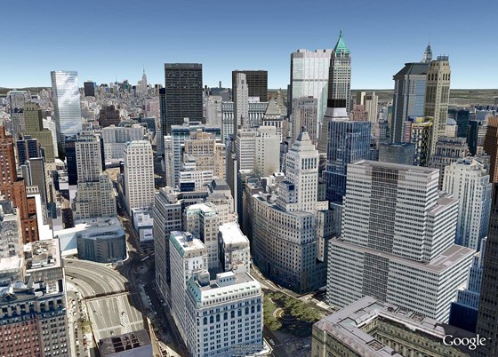
Google recently afforded the world a glimpse of a 3D version of Google Earth. And what we saw was truly mind-blowing. In a way, it felt that one was flying right over a city, viewing it all in 3D, such is the near-real 3D imaging of Google’s new Google Earth. We also reported that Google was using new techniques to render the 3D images.
Now, it is being reported that Google is trying to distance itself from the more conventional modeling tools, tools which required any degree of hand-sketching. Rather, the company is moving towards more automated tools and techniques.
The new image-based modeling algorithm that Google is using for its 3D Google Earth will be processing 45-degree aerial images automatically. With the help of this new algorithm, Google Earth will be able to show entire cities in 3D, together with full textures, accurate dimensioned buildings and other area.
In a video released by Google, the 3D view on Google Earth looks really stunning and very real. With the use of this new algorithm, Google has definitely taken a giant leap ahead in rendering maps more accurately, making them look more real.
According to Google, “Since 2006, we’ve had textured 3D buildings in Google Earth, and we’re excited to announce that we’ll begin adding 3D models to entire metropolitan areas to Google Earth on mobile devices in the near future.”
Source: Google
Courtesy: Slashdot


