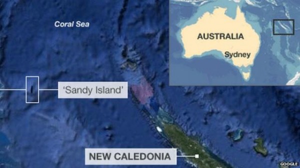
Seems like Sandy Island, that was supposedly located between Australia and New Caledonia in the Coral Sea, is playing hide and seek. This island has appeared on world maps for years, including Google Maps, Google Earth, coastal databases, and marine charts. But mysteriously this South Pacific island has disappeared! Australian scientists say, the island never existed in reality.
A group of Australian scientists from the University of Sydney went searching for the mystery landmass of Sandy island during a geological expedition. Scientists found there was no sign of Sandy island, rather they found blue sea only. How could that happen when an island has been appeared on world maps for years? Even Google Earth and Google Maps show Sandy island in the Coral Sea lies between Australia and the French-governed New Caledonia.
No doubt, that’s a solid question. To find the answer, scientists pointed out two things. Either that island has been disappeared due to erosion, or it could be the sizable phantom island in the Coral Sea has been named/assumed as Sandy island mistakenly.
Dr. Maria Seton, a geologist at Sydney University mentioned that based on Australian maritime research vessel Southern Surveyor, that used weather maps – Sandy Island don’t exist. She exclaimed, “How did it find its way onto the maps? We just don’t know, but we plan to follow up and find out.”
Source : Guardian
[ttjad keyword=”gps-device”]


