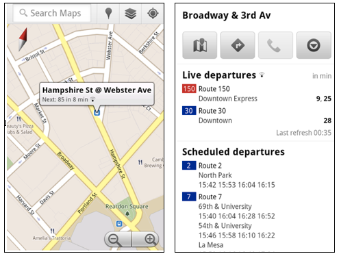
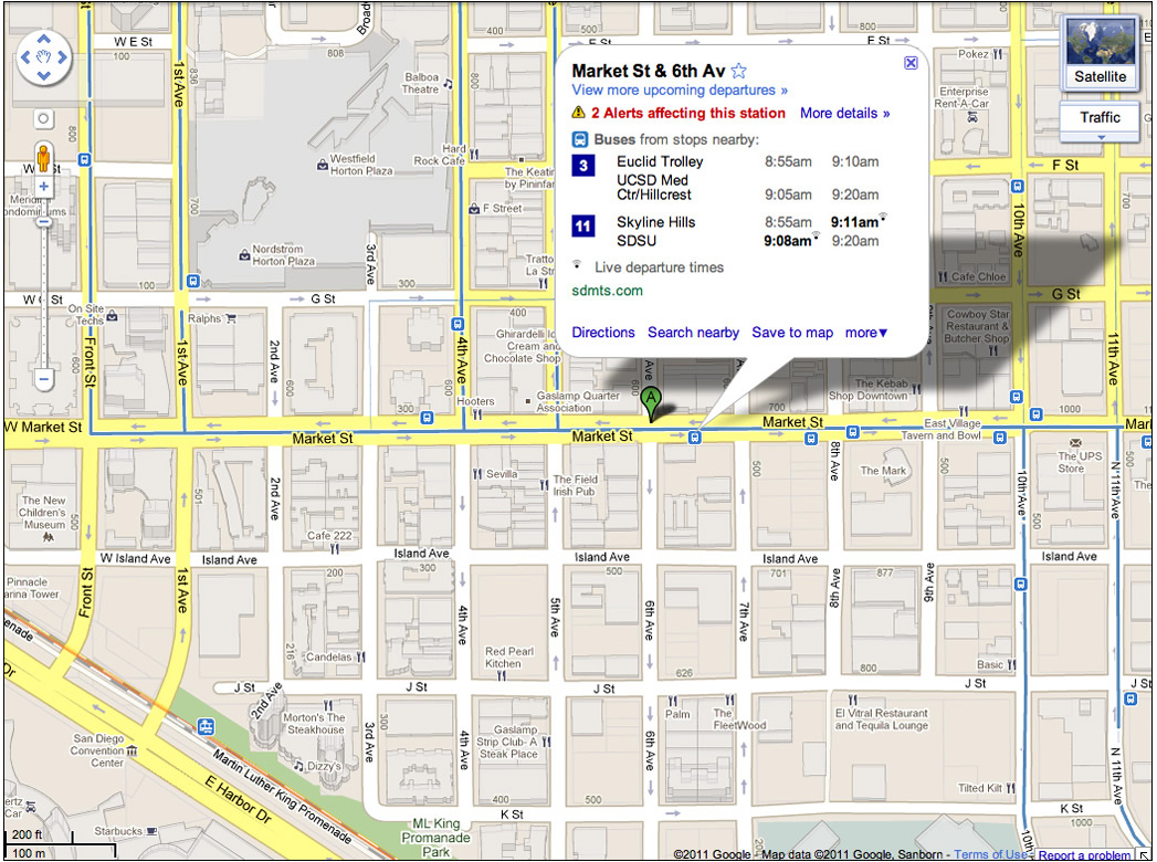
Google Maps now provides live transit updates and it tells you just how late your bus is. Google Maps team on Wednesday announced an update to both Google Maps for Android 1.6+ and Google Maps for desktop that incorporates real-time mass transit data, letting users not only plot their bus and train routes, but also track them in real time. The new google live transit data is only available in six cities worldwide: Boston, Portland (Oregon), San Diego, San Francisco, Madrid (Spain) and Torino (Italy) and the tracking feature is tied into transit stations included on the map……….
Google has introduced live transit updates into Google Maps on Desktop and Mobile browsers as well as in the official Google Maps Android application. Transit updates are live in Boston, MA; Portland, OR; San Diego, CA; San Francisco, CA as well as in Madrid, Spain and Turin, Italy. The service aims to tell you not just the scheduled arrival time of public transportation, but the actual arrival time as well, in real-time. While the schedules laid out by transit departments are excellent and are very handy tools to have, the plain truth is that nobody can predict traffic conditions and a schedule taped to the side of a bus stop isn’t necessarily foolproof. Google Maps hopes to offer you a real-time update on your transportation so that you can plan accordingly. Google is teaming up with more transit departments to deliver this service to more and more people throughout the world, but it’s definitely great to see it getting a solid start. A service like this will make a lot of public transportation users happy and forestall a good number of headaches from missed buses.
For example, if you search for “Sullivan Station Boston, MA” on Android’s Google Maps app, the location of the station is pinpointed with a sub-heading telling you where it is expected to stop next, and in however many minutes it’s expected. Clicking on the station name pulls up a menu with live bus departures along with scheduled bus and subway departures. When using Google Maps for transit directions, it adds live service alerts as they occur. When the same station is picked in Google Maps for desktop browsers, live bus and subway information is collapsed under the name of the train line or bus route number. The station’s landing page includes a live timestamp, a listing of nearby stations and their live data, scheduled departures, live tracking information, and user-uploaded photos.
[ttjad keyword=”general”]


